Vintage Maps

From The Lionel Pincus & Princess Firyal Map Division, The New York Public Library.
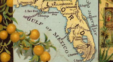
If you love using vintage maps in projects, you’re in luck. The Lionel Pincus & Princess Firyal Map Division of the New York Public Library includes more than 20,000 cartographic works, and they’ve been made available as free high resolution downloads.
You can view the maps through the New York Public Library’s Digital Collections page. To download the maps you’ll need to create an account, then click a map title and download it through the Map Warper.
“The Lionel Pincus and Princess Firyal Map Division is one of the world’s premier map collections in terms of size, scope, unique holdings, diversity and intensity of use. Established in 1898, our holdings include more than 433,000 sheet maps and 20,000 books and atlases published between the 15th and 21st centuries. The collections range from the global to the local scale and support the learning and research needs of a wide variety of users.
Through these projects, we’ve built up a great collection of: 1,100 maps of the Mid-Atlantic United States and cities from the 16th to 19th centuries, mostly drawn from the Lawrence H. Slaughter Collection; a detailed collection of more than 700 topographic maps of the Austro-Hungarian empire created between 1877 and 1914; a collection of 2,800 maps from state, county and city atlases (mostly New York and New Jersey); a huge collection of more than 10,300 maps from property, zoning, topographic, but mostly fire insurance atlases of New York City dating from 1852 to 1922; and an incredibly diverse collection of more than 1,000 maps of New York City, its boroughs and neighborhoods, dating from 1660 to 1922, which detail transportation, vice, real estate development, urban renewal, industrial development and pollution, political geography among many, many other things."
When using the interface of the library’s Map Warper site maps.nypl.org, you’ll be able to zoom and pan just like you can with Google Maps.
The site’s users will be able to warp the maps. Warping allows users to rectify the differences between an historical digital map and a more precise modern map of the same location using Google Earth, by stretching and aligning the older one over the newer one.
The NYPL states that they don’t know of any US copyright restrictions on the works in the map division, and are distributing the images under a Creative Commons CC0 1.0 Universal Public Domain Dedication, with the caveat: “...the maps may be subject to rights of privacy, rights of publicity and other restrictions. It is your responsibility to make sure that you respect these rights.”
The library is not requiring downloads to be credited, but they ask that you consider crediting your downloaded maps with the text "From The Lionel Pincus & Princess Firyal Map Division, The New York Public Library.”
· Don't miss: Crafting Resources, American Crafts, and Museum Collection Images.

Sanitary and social chart of the Fourth Ward of the City of New York, to accompany a report of the 4th Sanitary Inspection District. 1864.


All map images on this page are from The Lionel Pincus & Princess Firyal Map Division, The New York Public Library.
POPULAR POSTS
Follow a tutorial for making a patchworked bag with Sashiko topstitching. | Follow tutorials for how to create traditional Japanese embroidery stitching. | Explore a library's digitized vintage maps, which you can download for free. | Learn from a museum textile curator how to best care for your quilts. |
Learn to make a basket weave pattern quilt from scraps of fabric. | Sisters Lorna and Jill Watt create amazing yarn bomb installations . | Ceramic artists create fantastical structures using magnetic clay. | Learn about a Viking fabric-making technique which pre-dates knitting. |
Follow a tutorial for making a bilum bag - PNG's traditional fabric. | Learn to make a pinhole camera; develop paper film with common items. | Learn about a stretchy fabric made with connected loops. | Free digitized knitting magazines 1800 - now. |
